The Old Post Office ...
19 Market Place
Mapping the Marketplace
Use the map below to explore Swaffham’s North side, this section focuses on Ash Close to Lynn Street
Businness Name
No. Address
The Old Post Office ...
19 Market Place
Flowers
19,(19a,19b) Market Place
King’s Arms
21 Market Place
Poppi Interiors
23 Market Place
Aclass Barbers
25 Market Place
The Norfolk Groomshe...
27 Market Place
Swaffham Kebab and P...
29 Market Place
William H.Brown Esta...
31 Market Place
East Anglian Childre...
33 Market Place
Boots Chemist
37 Market Place
Wellbread Bakery
39 Market Place
Doghealth
41 Market Place
Jana: 43, Market Pla...
43-45 Market Place
Crown Inn and Sue Ry...
47 Market Place
Co-op Funeral Servic...
51-49 Market Place
The Gold Shop and Lo...
55-53 Market Place
Cranglegate
59 Market Place
This section begins at Ash close and ends at the “very old” Post Office where the Marketplace officially ends – although the street sign says different.
View Swaffham’s historic Market Place and map your journey
Discover the people who put Swaffham on the map
East Anglian Children’s Hospice - 33 Market Place
The Gold Shop and London Nails - 55-53 Market Place
The Old Post Office & Andrew Francis Funeral Directors - 19 Market Place
Wellbread Bakery - 39 Market Place
The Norfolk Groomshed - 27 Market Place
Cranglegate - 59 Market Place
Flowers - 19,(19a,19b) Market Place
Aclass Barbers - 25 Market Place
King’s Arms - 21 Market Place
Co-op Funeral Services and Morrisons - 51-49 Market Place
Swaffham Kebab and Pizza House - 29 Market Place
William H.Brown Estate Agents - 31 Market Place
Jana: 43, Market Place Children’s Society: 45 Market Place - 43-45 Market Place
Boots Chemist - 37 Market Place
Crown Inn and Sue Ryder House - 47 Market Place
Poppi Interiors - 23 Market Place
Doghealth - 41 Market Place
It does not include Ash Close – that has a history all of its own!
The south side has an interesting history but what remains is Lynn Street, so it has not yet been mapped.
On this side were the Plowright foundry and eventually the gas and water works as well as one of the five town water pits.
The 1839 map lists Swaffham Town House on this side of Lynn Street which has yet to be explored.
Explore the Market Place

The buildings in this street are just as old, if not older, than those on the marketplace but the occupants tended to be less well-known and moved more frequently.
The further away from the town the more likely the residents would be labourers, particularly agricultural labourers.
Before we venture towards Lynn Street we pass an important part of the wider Marketplace – the area which is now known as Pedlar’s carpark.
Explore the Market Place
The first Pedlar town sign, the one depicted on the image on the right, was first erected here in about 1923 and arose from a national newspaper competition design.
The craftsman used the mediaeval Pedlar carvings in the church as his inspiration.
He did not win but it caught the imagination of the town. It was remade by Harry Carter and unveiled in 1936 but without the seat.
Over the years it has been restored several times.
Explore the Market Place
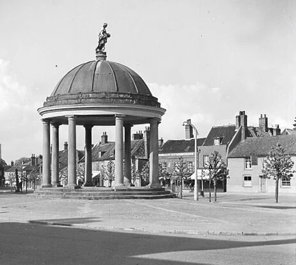
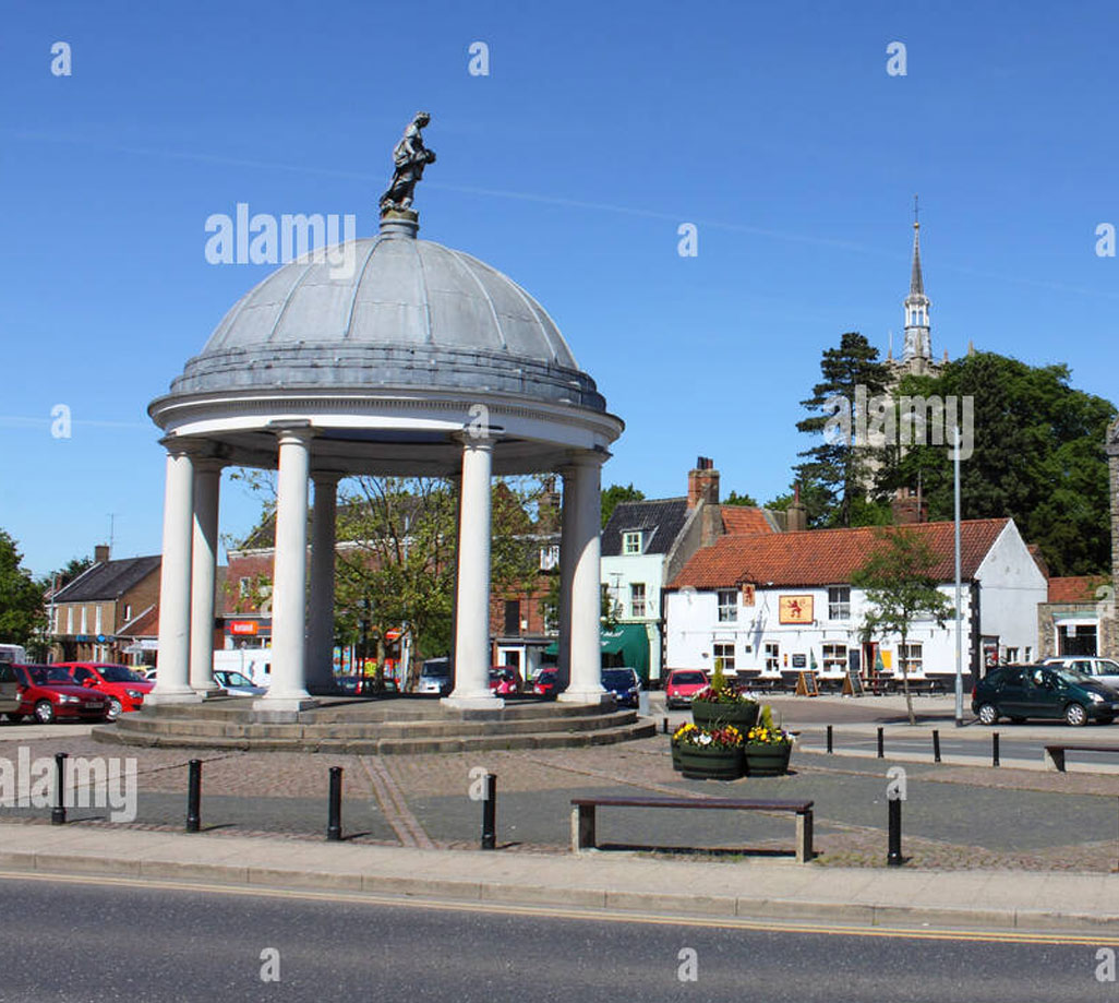
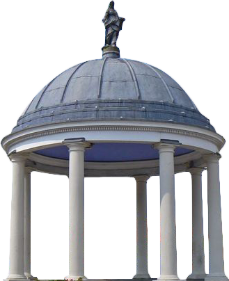
The Bagge memorial.
This domed water fountain was erected in 1883 in memory of Sir William Bagge of Stradsett Hall who had been MP for West Norfolk between 1837 and 1880 and who had died that year.
The memorial became the responsibility of the Urban District Council in 1934 and was recognised as needing attention at that time.
In 1840 the Council decided to demolish the fountain but keep the bust which is now in Swaffham Heritage Museum.
Explore the Market Place
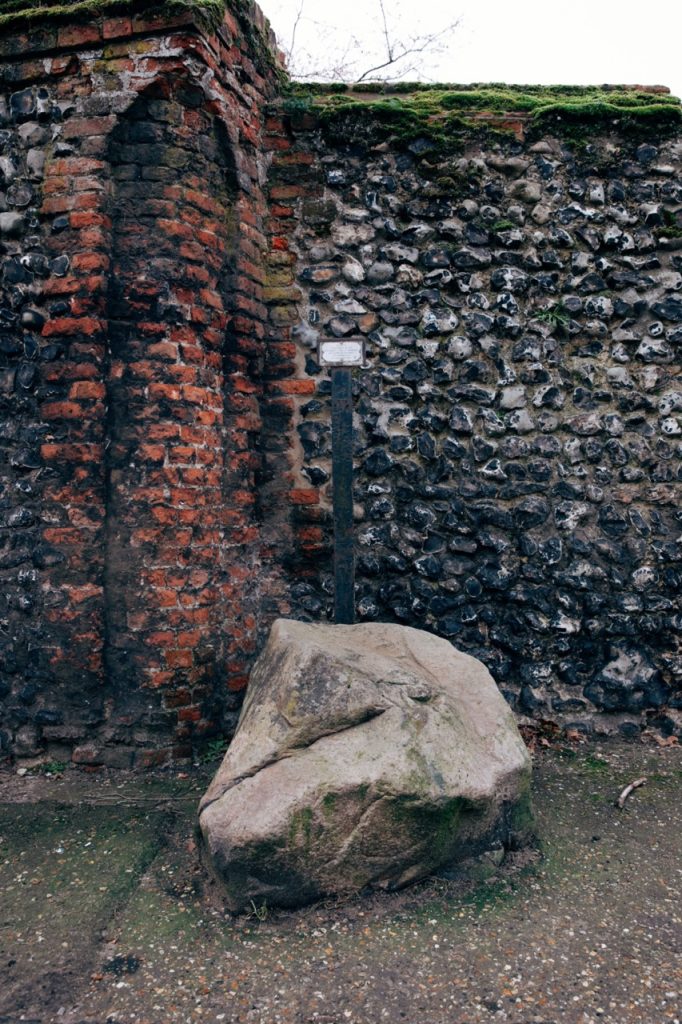
There is much speculation and no evidence for the origins of the settlement stone near the Sorting Office.
Was this glacial boulder a boundary marker for a Saxon settlement here and linked with the Saxon cemetery discovered on Cley Road in 1970?
Has it always been at this location? Or was it brought here by Norfolk Yeomanry soldiers to be used as a mounting block but never removed?
Explore the Market Place
Use the arrows & swipe across to reveal ![]()
Do you live here, did you live here and do you know of any interesting, historical facts you’d like to share with us.
We’d love to hear from you!
In Partnership with
Swaffham Heritage
©Swaffham Heritage 2024. All rights Reserved.